Pacific Coast, USA road trip
West Coast Road Trip itinerary
A West Coast road trip is the grand tour of America's Pacific edge, stringing together three states, a run of national parks and a string of great cities into one journey. This itinerary drives the whole coast from Seattle to San Diego over 11 days and roughly 1,650 miles, starting under the volcanoes of Washington, tracing the wild Oregon Coast on US-101, threading the towering redwoods of northern California, then following Highway 1 through San Francisco, Big Sur and the sun-soaked southern beach towns. It is a broader, city-and-parks route than a pure Pacific Coast Highway drive — you dip inland for Mount Rainier and the giant sequoia forests as well as hugging the shore. Fly into Seattle, out of San Diego, and let the road do the rest.
- Duration
- 11 days
- Distance
- 1,650 miles
- Start and finish
- Seattle to San Diego (north to south)
- Best time
- Summer to early autumn (June to September) is the safest window: the Pacific Northwest is at its driest and warmest, Mount Rainier's high roads are open, and the northern coast is least likely to be fogged in. September is arguably the sweet spot — thinner crowds once the American school holidays end, warm southern California and clearer skies up north. Avoid the winter months, when Pacific storms lash the Washington and Oregon coasts and mountain roads can close.

See the ready-made plan
The full West Coast Road Trip itinerary is already plotted in the planner, day by day. Open it to see the route on the map, then drag stops, add your own and keep notes as you go.

Why drive the West Coast Road Trip?
An 11-day West Coast road trip itinerary from Seattle to San Diego — Mount Rainier, the Oregon Coast, the redwoods, San Francisco, Big Sur and the southern California beaches.
- Mount Rainier's meadows and glaciers above Seattle
- The Oregon Coast's sea stacks, dunes and lighthouses on US-101
- The towering redwoods of northern California
- San Francisco, Big Sur and the southern California beaches
11 days West Coast Road Trip itinerary
Day 1
Seattle
Start in Seattle with a day on foot before you collect the car. Wander Pike Place Market, ride up the Space Needle, stroll the waterfront and the Olympic Sculpture Park, and take in the skyline with Mount Rainier floating behind it on a clear day. Pick up any road-trip supplies before an early start tomorrow.
Day 2
Seattle to Portland via Mount Rainier
Head inland to Mount Rainier National Park, about 90 miles, and drive up to Paradise for wildflower meadows, waterfalls and glacier views beneath the 14,411-foot volcano. Then cut south into Oregon, roughly 140 more miles, crossing the Columbia River into Portland for the night — around 230 miles all told.
Day 3
Portland to the Oregon Coast
Drive west to the coast at Cannon Beach, about 80 miles, to see Haystack Rock rising from the surf. Turn south on US-101 through Tillamook and Depoe Bay, stopping at viewpoints and the odd lighthouse, and overnight in Newport by its working harbour — roughly 205 miles for the day.
Day 4
Newport to Bandon
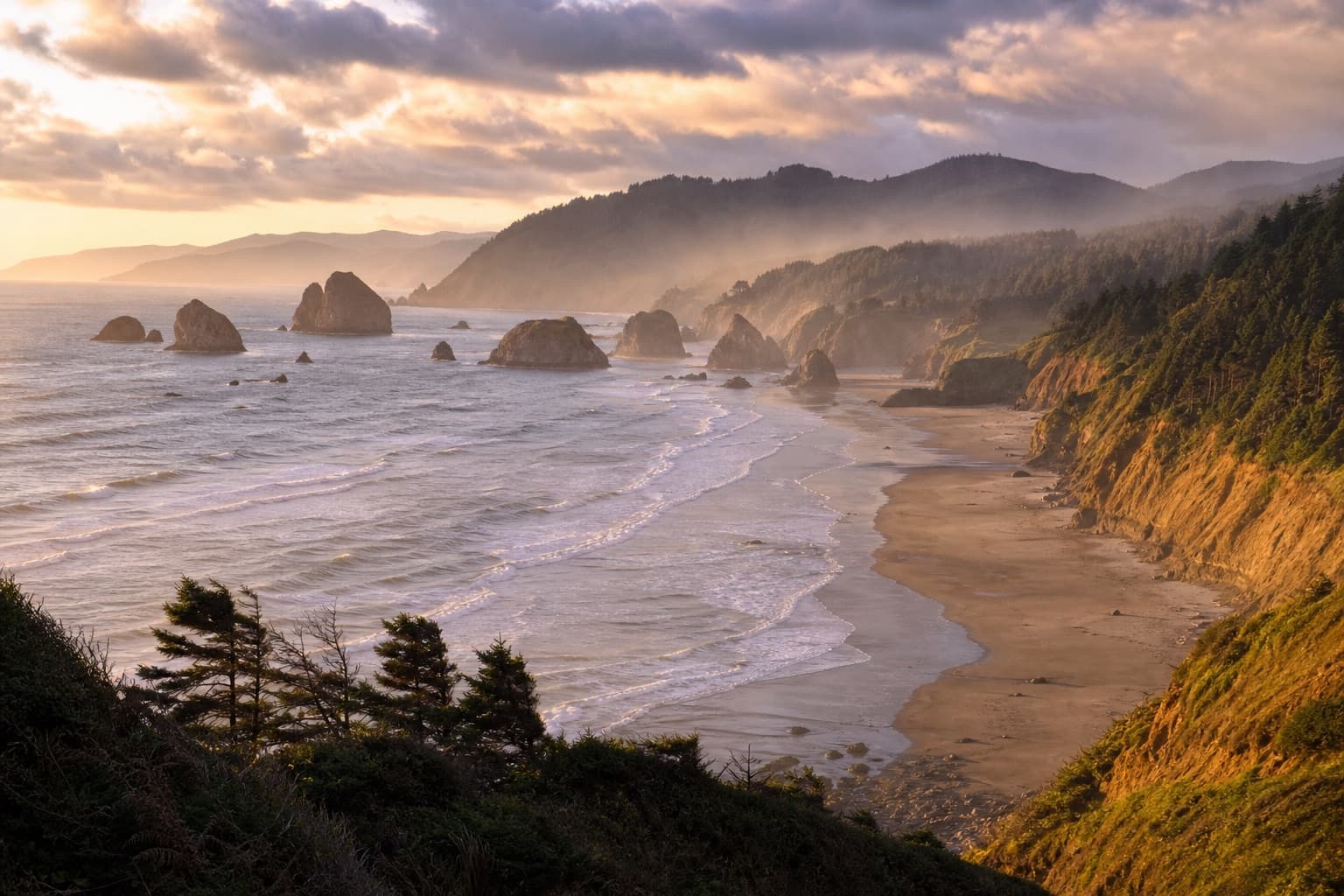
A slower coastal day of about 130 miles down US-101: the Yaquina Head lighthouse, the sea-lion caves and dramatic bridges around Florence, then the vast Oregon Dunes National Recreation Area. Push on through Coos Bay to Bandon, where sea stacks stud the beach at sunset.
Day 5
Bandon to Eureka via the redwoods
Follow the wild southern Oregon Coast past Gold Beach and Brookings, then cross into California, around 200 miles in all. The reward is the redwoods — Jedediah Smith and Prairie Creek in Redwood National and State Parks, home to the tallest trees on Earth. Overnight in Eureka on Humboldt Bay.
Day 6
Eureka to Mendocino
Drive the Avenue of the Giants, a hushed old-road detour through towering coast redwoods, then continue south, joining Highway 1 near Leggett where it meets the coast. It is about 150 miles to Mendocino, a clifftop New England-style village of water towers and headland trails.
Day 7
Mendocino to San Francisco
A spectacular, twisting 155-mile day on Highway 1 above the Pacific — sea cliffs, hidden coves and the Point Arena lighthouse — before the road turns inland and drops down to the Golden Gate Bridge. Cross into San Francisco and leave the car parked.
Day 8
San Francisco
Spend a full day in the city without the car: cable cars and the crooked Lombard Street, the Ferry Building and Fisherman's Wharf, Golden Gate Park and a walk or cycle across the bridge itself. It is the halfway point of the trip, so enjoy the pause before the southern coast.
Day 9
San Francisco to Big Sur
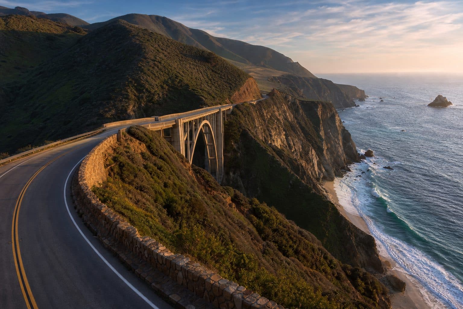
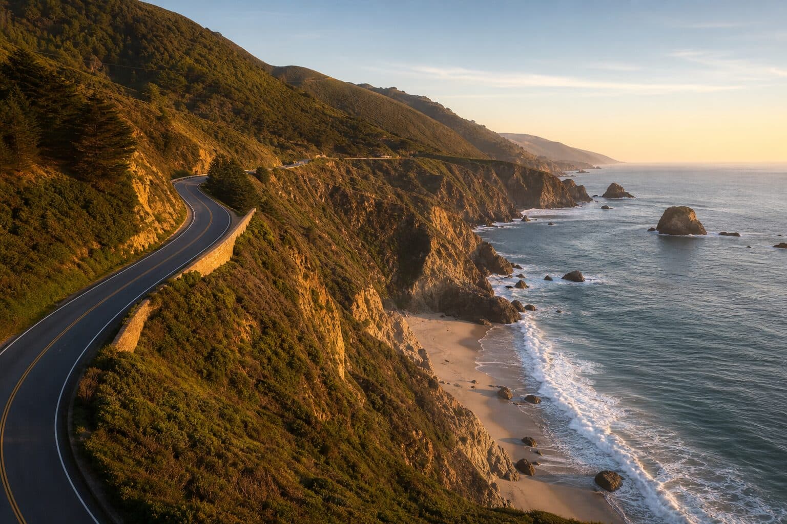
Rejoin Highway 1 south through Santa Cruz to the Monterey Peninsula — the aquarium at Monterey and the artists' village of Carmel — then into Big Sur itself, about 150 miles. Bixby Creek Bridge, McWay Falls and the redwood canyons make this the drive's scenic high point; overnight in or near Big Sur.
Day 10
Big Sur to Santa Barbara
Carry on down the coast, roughly 200 miles, pausing at the elephant-seal colony near San Simeon and the hilltop Hearst Castle, then Morro Bay's volcanic rock. The road eases as you reach Santa Barbara, a whitewashed, red-tiled town on the Pacific with a Spanish mission and a palm-lined beachfront.
Day 11
Santa Barbara to San Diego
The final leg, around 215 miles, runs past Malibu and through Los Angeles — worth a stop for Santa Monica Pier and Venice Beach — before the last stretch south to San Diego. Finish on the beaches of La Jolla or in the Gaslamp Quarter, coast complete from Puget Sound to the Mexican border.
Planning tips
Fly into Seattle, out of San Diego
This is a one-way trip, so book an open-jaw flight into Seattle and home from San Diego, and hire the car one-way. The drop-off fee is worth budgeting for, but it saves you the long, dull backtrack up Interstate 5 and gives you far more time on the coast.
Book the coast and the parks ahead
Rooms in Big Sur, along the Oregon Coast and around Mount Rainier are limited and fill months in advance for the summer. Lock those nights down first, then fill in the flexible city stops. Check Mount Rainier's timed-entry reservation system before you go, as it applies in peak season.
Don't underestimate Highway 1
The coast road is slow and winding — plan on averaging little more than 30 to 40 mph on the twisty sections through Big Sur and the Mendocino coast. Check for road closures too, as landslides occasionally shut stretches of Highway 1 and force an inland detour.
Pack for three climates
You will cross real weather zones: cool, damp forest in the Pacific Northwest, fog and wind on the northern coast, and hot sun in southern California. Layers, a waterproof and sunglasses all earn their place, and the coastal mornings are often grey before the afternoon burns through.
West Coast Road Trip FAQ
How long does a West Coast road trip take?
For the full Seattle to San Diego drive with national parks and city stops, plan on 10 to 14 days. This itinerary does it comfortably in 11. You could rush the bare coast in a week, but you would miss Mount Rainier, the redwoods and time in San Francisco.
How many miles is a West Coast road trip?
Driving the coast from Seattle to San Diego, with the inland detours to Mount Rainier and the redwoods, runs about 1,650 miles. The most direct route straight down Interstate 5 is closer to 1,250 miles, but the scenic coastal line is the whole point of the trip.
What is the best route for a West Coast road trip?
The classic is north to south from Seattle to San Diego: US-101 down the Oregon Coast, through the northern California redwoods, then Highway 1 through San Francisco, Big Sur and the southern beaches. Driving north to south keeps you in the slow lane nearest the ocean and saves the warm southern California finish for last.
Which direction should you drive the West Coast?
North to south is the popular choice. On Highway 1 the southbound carriageway hugs the ocean side, so you get the sea views and the safer pull-offs, and the weather generally warms up as you go. Driving south to north works fine too if your flights suit it better.
When is the best time for a West Coast road trip?
June to September is the most reliable window. Summer is the driest, warmest season in the Pacific Northwest and the surest time for Mount Rainier's high roads to be open. September is a favourite — the crowds thin, southern California stays warm, and the northern coast is clearer once the summer fog eases.
Is the West Coast road trip suitable for a first-timer?
Yes. The driving is straightforward — good roads, clear signage and English throughout — and the route is well set up for visitors. The main things to watch are the slow, winding coastal sections, US driving on the right, and booking the popular coast and park stops well ahead in summer.
Related road trips
Pacific Coast Highway Road Trip
Drive the full Pacific Coast Highway on California's Highway 1 from San Francisco to San Diego — Big Sur, Hearst Castle, Santa Barbara, Malibu and the southern beach towns.
- Duration
- 7 days
- Distance
- 600 miles
Oregon Coast Road Trip
Drive the full Oregon Coast on US-101 from Astoria to Brookings — sea stacks, lighthouses, the Oregon Dunes and the Samuel H. Boardman corridor.
- Duration
- 5 days
- Distance
- 363 miles
California Road Trip
Drive the California coast on Highway 1 from San Francisco to Los Angeles — Monterey, Big Sur, Hearst Castle, Morro Bay and Santa Barbara along the way.
- Duration
- 5 days
- Distance
- 470 miles